Maps can be drawn to represent a variety of information. today we know how to read a map and important signs and symbols in a map.

Maps can be drawn to represent a variety of information. This information can include roads, tourist attactions and campgrounds as well as an illustration of the latest weather patterns.
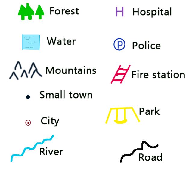
The objects on a map are represented using symbols. A symbol is a picture on the map that represents something in the real world. These symbols can be understood with the help of a key. maps use a key or legend to explain the meaning of each of the symbols used in the map.
These keys usually show a small picture of each of the symbols used on the map, along with a written description of the meaning of each of these symbols.
Scales :-
Maps show teeny-tiny versions of places. It is a tool for measuring distance. The scale helps the reader identify the relationship between the area represented in the map and the actual area of the place. a map scale is written like a statement eg. 1cm to 250km etc.
Here, it is important to remember that the distance represented by the map scale refers to the aerial distance between two areas. This is because the rail and road distances may vary due to certain possible diversions.
Directions :-
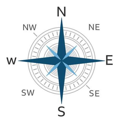
The sun always rises in the east and sets in the west. So, if you know the direction of sunrise, you will be able to locate the east. if you stand facing east, your back will be towards the west direction. Now stretch your hands horizontally. Your left and right hands will face north and south respectively. Besides these four main directions, there are four sub-directions- north-East, North-west, South-East and South-west.
The top of the map is always taken as north, the bottom is taken as the south the left side indicates the west and the right side indiacates the east direction.
Globe :-
A Globe is a three dimensional scale model of earth. The word ‘Globe’ comes from the Latin world Globus, meaning round mass or sphere.
A Globe is a model of the Earth. The Earth is so large that we cannot see its entire surface. A model of the Earth helps us to understand what the whole Earth looks like. a globe is a better model of the Earth than a flat map, because Earth is sphere, which is like a ball. so, a sphere-shaped globe can represent the earth more accurately than a flat piece of paper.
The earth spins or rotates on its axis. You can observe the axis on a globe. It is a narrow metal piece or pole that runs through the globe from top to bottom. On the Earth, the axis is just an imaginary line around which the Earth rotates or spins. The top of the axis is the North Pole, while the bottom of the axis is the South Pole.
Latitudes and Longitudes :-
The location of any place on the Earth is defined by its two characteristics, that is latitude and longitude. Cartographers and geographers trace horizontal and vertical lines called latitudes and longitudes across coordinates and represent the angular distance of any location from the center of the Earth. Both latitudes and longitudes are measured in degrees and minutes. Just like a house has its address (Which includes the house number, the name of the street, city etc) every single point on the surface of the earth can be specified by the latitude and longitude coordinates. Therefore, by using latitudes and longitudes we can specify virtually any point on the earth.

